You might also like…


“California Gold” slate tile arranged in a Versailles pattern.
There are many wonderful things that can be said about slate tile — about how durable it is, how great it looks, and how versatile it can be — but there is one thing that you won’t realize until you actually have slate tile in or around your house.
Slate feels like heaven on your bare feet!
It’s definitely a nice, unexpected perk of what has become a hot trending material in dozens of home applications. With a fine grain and huge array of colors, slate tile has been in use for centuries. Long before it graced lawns and floors, it was used as a roofing tile, and even as a way of communication — thin slate boards and a piece of chalk were often used as a handy notepad. It was an eco-friendly solution in place long before the term was coined!
Today, slate is popping up everywhere, and homeowners are discovering a myriad of uses for the attractive stone.
The basics of slate tile
Slate became a popular roofing material when it was discovered that not only did it break cleanly into thin sheets, but that is was also easy to stack. Slate can be heavy, but it makes up for that by being waterproof, fire resistant, and durable enough to withstand almost anything Mother Nature can throw at it.
Soon slate was being used inside the house, especially in high-traffic areas, such as foyers and hallways. Though black, gray and multi-colored are the most popular hues, slate is available in a wide variety of colors for every design whim. Slate has often been used in a more natural state, with rougher edges — however, tiles are becoming more popular, especially those that are 12″ x 24″. Flat and smooth planks are also becoming all the rage, with an installation that looks similar to that of a hardwood floor.
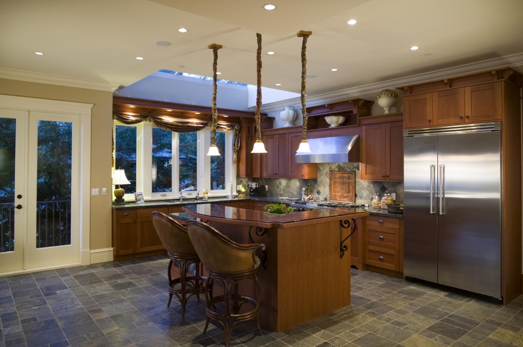
Recognized for beauty and durability, slate is finding its way to other areas of the home. It can be found on kitchen and bathroom floors, where it is prized for the waterproof quality, as well as the luxurious visual effect. It might even be found in living rooms, especially around the hearth of a fireplace or as an accent to French doors.
Perhaps surprisingly, many homeowners are turning away from paint or wallpaper and putting slate tiles on their walls instead. This dramatic look can be found in bathrooms and kitchens, but has also made its way to other areas of the home, such as the entryway. The look of slate tile can add an air of opulence to any area.

“Golden white” slate tile.
Slate tile heads to the Great Outdoors
One of the fastest-growing areas of slate use is outside. Some slate tile is very resistant to thaw and freeze cycles, making it the perfect option for walkways, garden pavers and patio tile. Those who want to keep a natural look can opt for tile with natural edges, cut in a way that reveals the true beauty of the stone without any enhancements. Those who want a more streamlined look can opt for cut tile, perfect rectangles or squares that line up precisely — perfect for a walkway leading to a handsome courtyard.
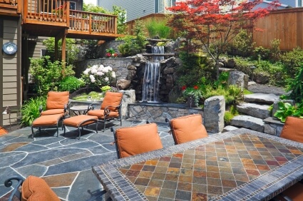
A full courtyard, patio or entertainment area covered in slate can lend a smooth, cool look. For those who want things a little more rustic, consider slate with a natural finish, and stay away from polished options. The more natural look is especially welcome in areas where the stone is the star of the show, such as the meandering walkway from the house to an outdoor pergola.
Choosing slate tile surfaces for flooring and wall cladding
And keep in mind that slate tile isn’t just for those with unlimited budgets. Though slate has sometimes been seen as the pricey and opulent option for those who are looking for a high-end material, slate tile is now considered very affordable. The best prices can be had on black or gray tile, so expect to see a bit of a higher price tag on tile that is of various colors, such as cream or gold.
Regardless of the slate you choose, rest assured that when installation is complete, you will be thrilled with the look — and the way it feels on your feet when you take an evening stroll!
 (No Ratings Yet)